
Epic Charging enhances the precision of your charging station locations on the map, ensuring a more accurate representation for your end users, making it easier for them to locate charging stations.
1. Start by navigating to the 'Maps' tab within your Epic account.
2. On the map you will find:
1. Start by navigating to the 'Maps' tab within your Epic account.
2. On the map you will find:
- Locations with number of chargers in this Location and pie chart with the chargers statuses
- Vehicles with Vehicle Name and State of Charge
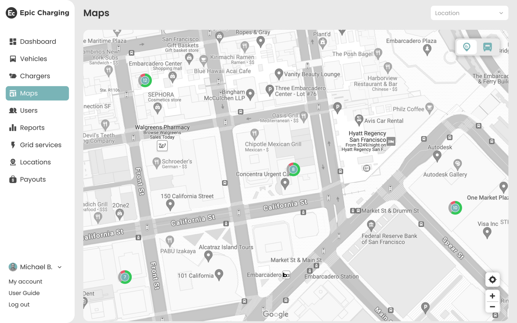
3. To switch between “Locations” and “Vehicles” viewing modes use the 'Locations/Vehicles' switch button in the top right corner of the map. To Zoom in and Zoom out the map use the '+/–' buttons in the bottom right corner of the map.

4. You can choose the Location you want to have a closer look at in the filter. Hover over the Location pin to see additional information about the Location:
- Location name
- Location address
- Location geographic coordinates - Latitude and Longitude
- Number of chargers in this Location grouped by statuses
- Button 'Adjust Position'

5. To adjust the Location position click on the ‘Adjust Position’ button. You will be able to move the Location pin within a radius of 1,000 feet from the actual address. Move the pin, then click on the ‘Save’ button. The Location position will be adjusted and Latitude and Longitude values will be updated.
